Monday, 23 May 2011

Wherigo- Treskilling Trek

This geocache deserves a post of it's own- its the best geocache we've done so far. A truly interactive way to play geocaching hide and seek. 


The wherigo took us to a section of the Clay Trail from Bugle to the Eden Project.  The view was amazing...


It was a good path that we nearly didn't take as we had parked quite a long way from the start of it as we wanted to do 3 other caches first and when we got there we ummd and arrrd over whether to leave it for another day as we knew there was a possibility of rain. Fortunately we carried on...


One of the wonderful things about geocaching is that you meet other friendly people. We bumped into two cyclists who had stopped to watch an adder asleep who was sluggishly laying across the path. We all stood taking photos and admiring the natural beauty of Britain's only venomous snake.


The snake was much smaller than I thought they would be, and I was surprised that it was so reluctant to move- though it does look as if it had recently eaten- notice the bulge in it's middle.


The wherigo led us to a hidden lake where we saw some geese and goslings.


There were rafts of lilies spread around the lake- I had never seen lilies like this before


Nearby were some cliffs which not only looked like amazing sand sculptures, but were also home to a colony of rare sand martins- there are estimated to be only about 200- 300 breeding pairs in Cornwall so it felt like a privilege to see them flying in and out of their burrows.


The scenery is very artificial if you look closely...
the lake is actually an old pit that was last worked in 1971. It has since been allowed to flood and is now 15m deep.


In the background, a spoil 'mountain' and an old chimney, man's interference with nature is all around here...


The Wherigo took us all along the trail but on the way back we diverted to look for another cache. How do people find these locations? We wouldn't have found this place in a million years without being led there by a cache.


It truly looked quite swampy in places... appearing like a different world from the clay trail, but only a hundred metres or so from the lake in the clay pit.


We took some photos of each other on this walk which I will post on my personal blog Creative Serendipity ( http://creativeserendipity-gmg.blogspot.com/ ).


So until next time
Gillian

Sunday, 22 May 2011

Clay Country

Today we went geocaching along the Clay Trail from Bugle to the Eden Project.

At the start of the trail was this stunning statue. I don't know why they chose to put a horse here but it a beautiful sculpture.

The path is unexpectedly well developed given that it is in an area that is essentially man made as a result of the extraction of china clay and other minerals which has resulted in an artificial landscape.


We found three geocaches along this part of the trail, two were cleverly camouflaged adding a nice bit of interest and challenge- though it didn't take us long to find them.

We then walked further along the trail to do a Wherigo geocache- the only bit I didn't much was the section we had to walk along the road itself- you can be as careful as possible but you are putting your life in the hands of other peoples careful driving doing that...


As we walked along I noticed a mine chimney sticking out of a field. We walked to take a closer look and found it, with some stables built right next to it. I really like that in Cornwall the old stacks are all around but are just being absorbed into the modern landscape.


You can't go far in Cornwall without seeing a mine chimney...


Most of the landscape in this photo is artificial, being built on china clay mining waste.

Two more spoil heaps; locally they are sometimes called the Cornish Alps. I actually quite like them, they are being returned to a natural state and are quite a sight.

I've got loads more photos of the Wherigo cache walk itself that I'll post tomorrow
So until next time
Gillian

Sunday, 15 May 2011

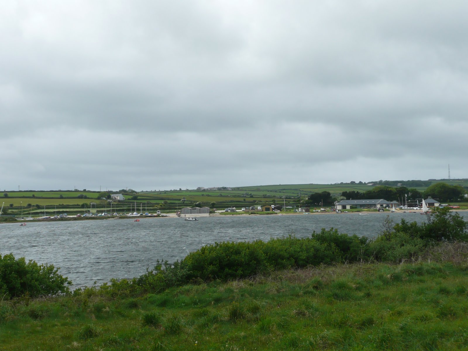
The windiest lake in England!

Today we went geocaching at Stithians Reservoir which is supposed to be the windiest lake in England. It certainly was really windy, enough to blow the cobwebs away, as my mum would say.


Wild iris
 We saw beautiful wild flowers, insects and birds...
Damsel flies were all around.


One of the many herons we saw

 The windiest place on the whole walk was crossing the dam... we just had to rush across... it was quite scary...


The dam

We enjoyed the walk immensely. The geocaching was difficult with some really hard to find caches  though we got 12 so we feel pretty pleased with ourselves...

Until next time
Gillian

Sunday, 8 May 2011

Colan Woods (and Haunted villages!)

Wild trees
The weather was better today so off we went to Colan Woods. (We had a hard time finding the parking spot so have agreed we need to buy a Satnav for the car as we are starting to travel further afield on some very narrow single track roads where you really don't want to do more miles than you need, and you definitely don't want to have to try to turn around!)


Once we finally got there, we found 6 caches in the wood. We also bumped into another local geocaching family who amazed us by managing the route with a buggy- it was prettty muddy!


We were totally intrigued by a mass of ruined buildings in the woods. It looked like a significant hamlet with a school house, possibly a chapel/church and several other buildings. We guessed they must be from at least the late 1800's when it became expected for children up to the age of 12 to have an education (being married to a history teacher does teach you something!)


Sean clambered all over the walls

 This building had 2 stories and maybe a bell window...


We came home and googled Colan Woods ruins and came up with some strange results. Some people claim that the hamlet was haunted and even that all the villagers suddenly disappeared without trace one day in the early 1900's. We didn't find the "time slips" suggested or feel the haunted atmosphere.... It was however unexpected to find a hamlet that must have been totally abandoned in the relatively recent past.


Nature is now reclaiming the site, to the point where many of the walls in the woods are now almost completely covered with moss and ivy. It really is an amazing place and will linger in my memory for quite some time. It would make a great setting for a mystery story... for when winter comes and we can't go geocaching because of the weather...


Until next time
Gillian

Saturday, 7 May 2011

A funny day geocaching!

It's been a funny day geocaching today. The weather forecast was awful, with heavy rain and thunderstorms predicted, so we abandoned our plans to walk in Colan Woods near Newquay. Instead we went to Trago Mills to shop for wool and stationery. While there we found the geocache in the woods by the store. Who would think there were some quite pleasant walks near such a big store!

In the afternoon we went to nearby Lanivet where there are two multipart geocaches requiring you to go to a number of locations to find numerical clues around the village to give the co-ordinates of the final caches.


Celtic cross in the graveyard
Some of the clues were at the local church, where we met a delightful lady who was about to do the church flowers. She let us look around the church and told us about the beautiful stained glass windows. She also told us that there had been a church on the site for over a thousand years, and they have a list of rectors on the wall going back to the 1200's. It was also probably a pagan scared site before that. Lanivet is actually the geographical centre of Cornwall and is halfway along the Saints Way which goes from Padstow to Fowey and was the route Irish pilgrims took towards France, hence it's importance.
Celtic cross near the bell
tower and war memorial


Lanivet Church 


We collected all the numerical clues, did the maths and went looking for the first cache. We got close, but the GPS pointed to the middle of the main road, so we used common sense and the cache name Road to Nowhere to guide us.... it wasn't enough today...


By then it was getting overcast, and we really didn't feel like getting wet through as we had both gone out without coats, so we called it a day... 


We will have to go back and try again another time.


Until next time
Gillian

Monday, 2 May 2011

Geocaching on Goss Moor

Goss Moor is a Nature Reserve we have seen many times from the road but never visited before. Several new geocaches have been placed there recently so we decided to visit on May Day Bank Holiday.


Sleepers marking the line of the old track
From where we parked we walked along a disused railway line into the reserve. The evidence of it still there in sleepers embedded in the path.
Sean pointing to the sleepers


The clay chutes
We found the old platform where the china clay was loaded onto the train trucks via clay chutes. 


Along the walk we had to climb gates, not something I was born to do... if only they gave me a hand instead of laughing and taking photos!


We also found the dodgy foot bridge that seems to be on every walk we do - this one had a loose hand rail, which made it safer to cross without holding on to anything...


We also found a bit where the stream had flooded across the track - we didn't want to turn back so we had to go round by jumping across where it was narrowest...


Sean and me needed a hand with this one...


We were so glad we continued. It was beautiful...

 Hidden in the trees, John spotted a sign. 


 We didn't see many people- just a few "Moo-gles"!

We had seen plenty of evidence of cows all afternoon- and had nearly trod in it a couple of times- but suddenly as we went round a corner we saw a whole herd of cows and their calves.

We found 6 caches on a fantastic walk. We have a few more to do here so we will be going back in a few weeks...


Until next time
Gillian

Sunday, 1 May 2011

Grogley Woods

We visited Grogley Woods today, targeting 6 caches. We found them all but got pretty wet along the way. It's the first time we've geocached in the rain. Does that mean we're serious geocachers now?

Just before the rain started  I took some photos of the view looking back towards Bodmin. The Beacon is clearly visible: we live to the left of the Beacon as you look at the photo...


These views shows the stunning valley between Grogley and Bodmin.


And finally - walking up the trail. There was a lot of climbing uphill on this walk and it rained very heavily just after the second cache, and again on our walk back downhill to where we had parked. We got soaked to the skin but loved every minute of the walk!
Until next time
Gillian
Related Posts Plugin for WordPress, Blogger...